Excursion to Wilno
Article by Peter Satterly. Photos by Maureen McPhee and Owen Cooke. June, 2017
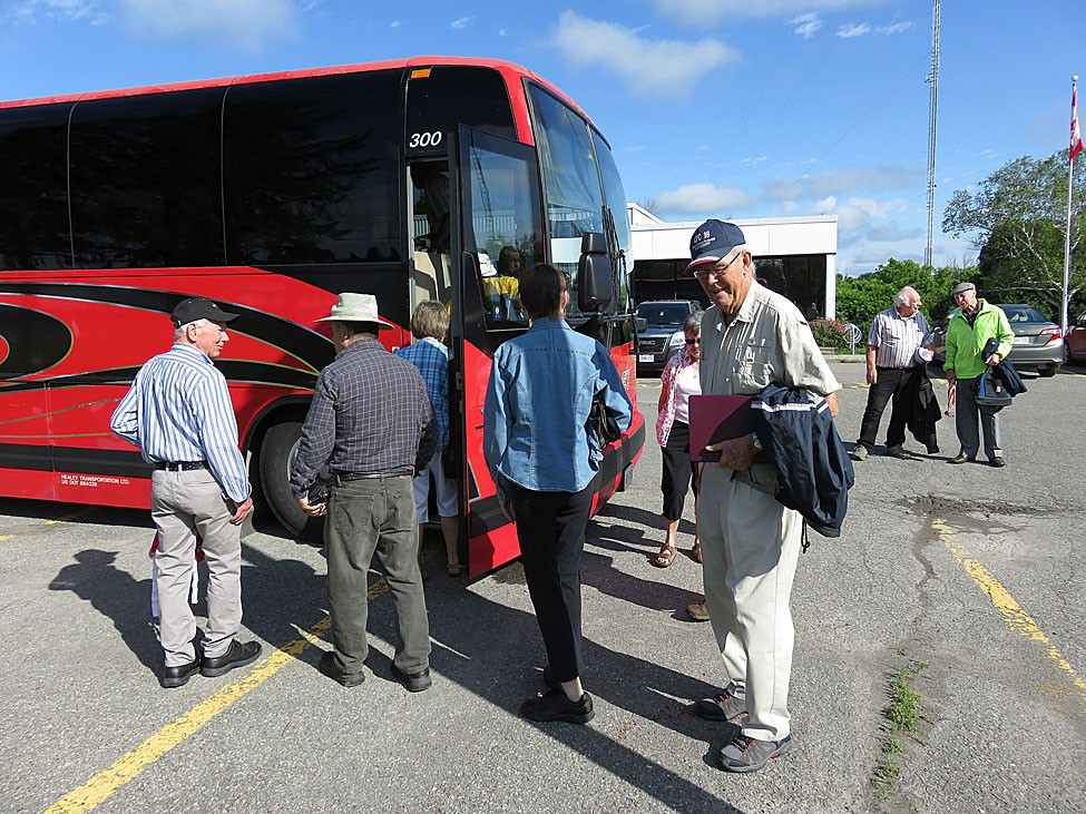
A bright red bus was waiting for us at the North Gower Client Centre. Skies were clear with a light breeze from the west. We boarded the bus and left at 08:50 for Wilno via highways 416 and 417.
At Hwy. 60, we turned west and passed through Renfrew and observed the old buildings along the main street. After passing the downtown area, we turned onto Hwy 132 to head west towards Dacre. Hwy. 132 was part of the colonization road, the Opeongo Road. Owen had passed out a map showing the colonization roads in eastern Ontario of 1863. A very interesting map from my perspective since I also travel along one of the colonization roads, the Monck Road which goes between Bancroft and Rama on Lake Couchiching, to go to our cottage on Lake Simcoe near Orillia.
Dacre was at an important crossing point of roads: the Addington Colonization Road which came north from Napanee, through Kaladar (Hwy. 7) and Denbigh (Hwy. 28 – Mississippi Colonization Road), and the Opeongo Road which proceeded from Renfrew through to Algonquin Park. Originally Upper and Lower Dacre, it was the largest settlement on the Opeongo Road beyond Renfrew, and was located along Constant Creek. Owen told us that Constant was the name of an important Indian chief in the area.
After reaching Dacre, we turned north on Hwy. 41, passing Renfrew County Road 64, the Opeongo Road, continuing north on Hwy. 41 to Eganville at the junction of Hwys. 41 and 60. Owen told us that one of the features of Eganville was the propensity for burning churches. He pointed out the Catholic and Lutheran churches, both of which had been burnt down and replaced by modern buildings. I was impressed with the very artful steeples for these two churches. I was also intrigued by some of the old store fronts as we went through the downtown. I have always been intrigued by Eganville, knowing that two young fiddlers and step dancers, the Pilatskis, came from Eganville. I had seen them at fiddling contests at Lanark and Pembroke.
We continued north on Hwys. 41 and 60 until Hwy. 41 branched off to the north to go to Pembroke and followed Hwy. 60 west towards Golden Lake and our destination at Wilno. As we continued, we passed Killaloe, which, as Owen pointed out, has the reputation as being the coldest town in the province. As we passed Killaloe, Owen told us of the road that ran parallel to Hwy. 60 called the German Road, which was mentioned in the book, A Harvest of Stones. The first church along this road was St. Stanislav, the first station in the forest. It was burned in 1916.
As we approached Wilno, we observed St. Mary’s Catholic Cathedral, the largest of churches. It was an impressive building on top of the hill a few miles east of Wilno.
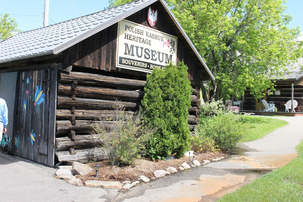
On entering Wilno, the village being at the bottom of a hill, we saw the museum, which was to our right at the bottom of a long hill beside the old right of way of the Ottawa, Arnprior and Parry Sound Railway, the railway built by the lumber baron J.R. Booth.
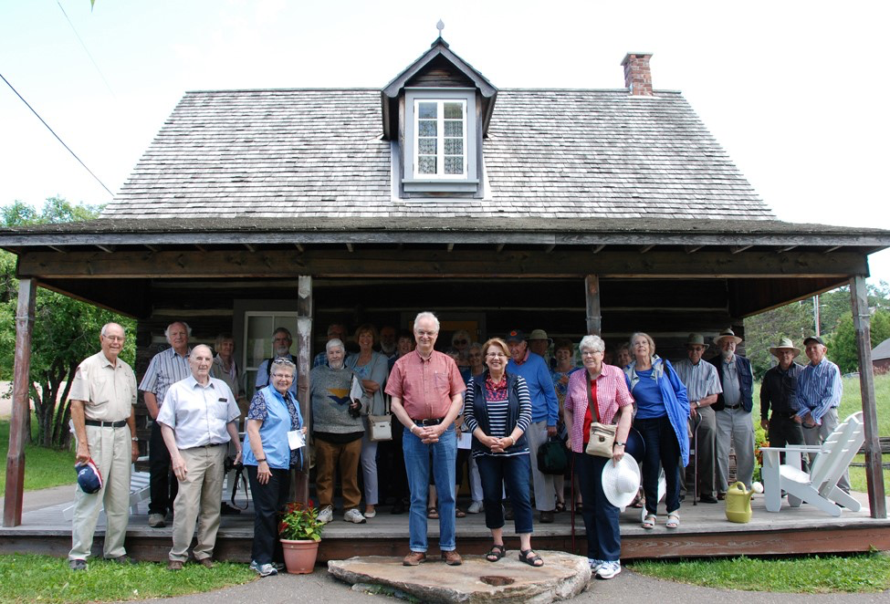
The museum consisted of a number of pioneer buildings: a house, blacksmith shop, etc. which had been donated by families in the area. The main farmhouse was donated to the Wilno Heritage Society on Feb. 1, 2004 by the Burchat Homestead Fundraising Committee and moved to Wilno Heritage Park on Nov. 2, 2006 where it was restored by the Society and friends of the Polish Kashub Culture. It was opened on Aug. 2, 2008 as part of the 150th Anniversary Celebrations for the Arrival of the First Kashubs in Canada in 1858. I was impressed as to the roominess inside the building and the bedroom area on the second floor. However, when I considered a mother and father and 3 or 4 children, I realized that for all those people, the house would be rather cramped!
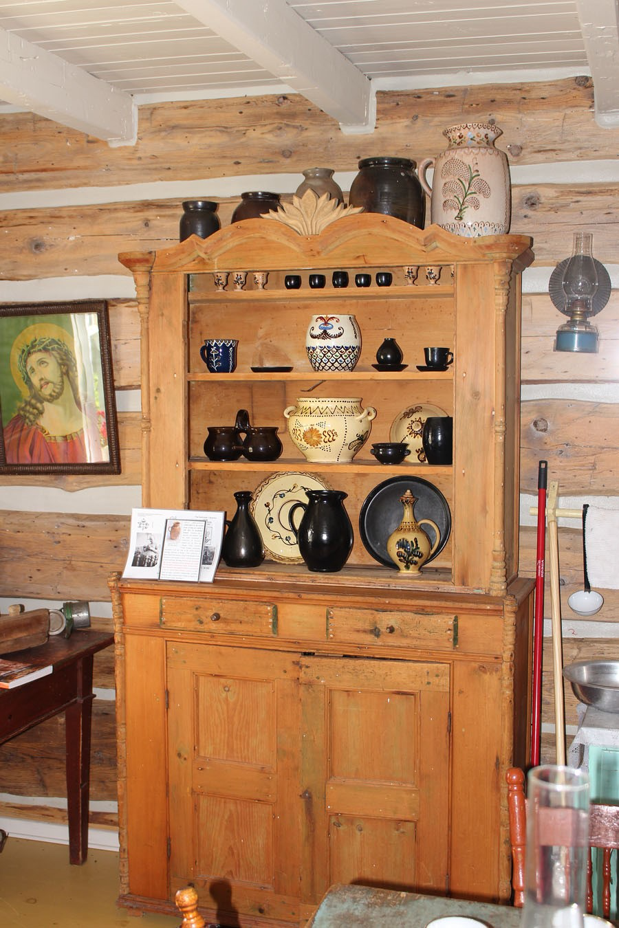
In addition to the farm house, there was a welcome centre and heritage store, a log shed and stage, a timber frame shed, Wilno Blacksmith and cabinet maker’s shop and a scoop roof shelter and crosses. Our hostess, Shirley Mask Connolly, Curator of the Kashub Heritage Village, noted that these buildings were furnished with representative furniture. A brochure given to us notes that settlers lived a life of subsistence on the land, built their homes from the pines that towered over them, at the same time clearing fields in the forest. The homes were furnished with home-made tables, chairs, benches, dish dressers, cabinets, chests, cradles and beds, generally made of softwoods and crafted into utilitarian pieces. Most families made their own simply-fashioned furniture.
The most well-known Wilno furniture makers were John Kosloski who built furniture from the mid 1870s through to his leaving the area in 1903 and John Borutski who came to the area in 1884 and died in 1910. Master cabinetmaker, John Borutski was trained in the Kociewien region of Prussia (Pomerania), in or near his home village of Lniano. There is also evidence that Kosloski had helpers/apprentices including Frank Lipinski. Other apprentices were likely John Chippior, Vincent Chapeskie and, perhaps, Frank Voldock.
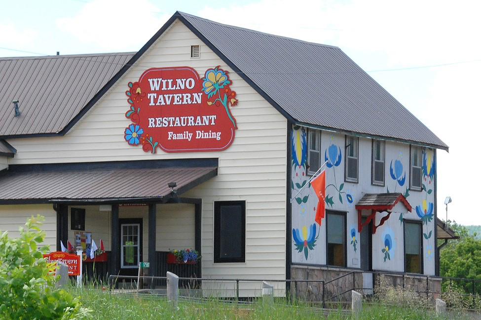
After our visit to the Heritage Village, we all boarded the bus to take the trip to the Wilno Tavern, which, as it turned out, was across the road! We then enjoyed a traditional Polish meal of cabbage rolls, Polish sausage with sauerkraut, perogies, mashed potatoes and shredded beets. For dessert, I had a piece of blueberry pie. The piece must have been close to one quarter of the pie!
 We continued on County Road 66 and came to Brudenell. On the left was St. Mary’s “Our Lady of the Angels” church. The church was built between 1868 and 1871, an enormous achievement for the 200 families of the congregation. Across the road was the old rectory, which at one time housed four priests.
Owen told us that Brudenell was established in the aftermath of the Crimean War and was named for Lord Cardigan, commander of the Light Brigade of cavalry, who famously said, “Here goes the last of the Brudenells” at the beginning of the Charge – “Into the Valley of Death Rode the Six Hundred ….” Although once a thriving village of over 100, the hamlet now has only 2 permanent residences – the rest are summer homes. The frame building was Costello’s Hotel, once described as “the sin bin of the Opeongo.”
The next point of interest was the radar station at Foymount. It was once part of the southern extension of the Pine Tree Line of early warning stations, built in 1952 but closed in 1974. It is still the highest populated elevation in Ontario and boasts a CBC repeater station. Unfortunately, we were not able to visit the location, just whizzing by in the bus!
Continuing southeast along the Opeongo Road, we came to Lamberts Road and Clontarf. The cement-block Baptist Church was built in 1914 and now holds only an annual fund-raising memorial service. The graves in the nearby cemetery suggest this was a German congregation.
St. John’s Lutheran Church was built about 1890 to replace an earlier church. Services here were in German until the 1920s. Now there are only monthly summer services, in English.
Further down the road, we whizzed by St. Clement’s Church. Under the clapboard is log. The church was built in 1892 and holds services in the summer. In the winter the services are held in parishioners’ houses.
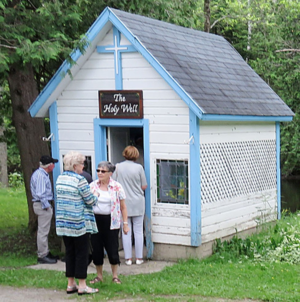
After passing St. Clement’s Church, we continued to the intersection with Hwy. 41 and Dacre. Returning along Hwy. 132 past Dacre, we continued to the road that went to Mount St. Patrick. Mount St. Patrick was the location where the original Catholic priest, Rev. Michael McNulty, settled, starting a religious community. He established a network of chapels throughout the area, a wise idea considering the difficulty in travelling in the area. We stopped and walked the short distance to the cemetery and St. Patrick’s “Holy Well”, a small building with a well. Using a dipper on a long pole, one could obtain some of the water. Interestingly, the container in which you put the water said, “For external use only!”
After returning to Hwy. 132, we continued east to Renfrew. Of personal interest to the writer of this account, was to see the original right-of-way for the old Kingston & Pembroke Railway. I have seen it on other occasions when I have travelled the road and was able to see it again. On the south side of the highway, somebody has made a gravel road along it for a short distance, which made it easier to see.
After passing partway through Renfrew, we turned south on the Burnstown Road. Owen pointed out some of the large houses on the south side of town, which were built by some of the wealthy lumber barons of the region.
At the south end of the Burnstown Road, Owen pointed out the general store on the left, part of which had been turned into a publishing house for local history books. However, the publishing house had now ceased to exist because of the high cost of publishing. This writer’s recollection is that it is the venue for musicians to play at the Burnstown “Hotel”.
We returned to North Gower at around 5:30 pm.
