The Rideau Canal at Manotick: the Early Years
Article by Ron Wilson in the RTHS newsletter - May, 2009.
The Rideau Canal opened in 1832, but the bulkhead dam at Watson’s Mill was not built until 1858. This raises the question of how the canal worked in the Manotick – Long Island area in the intervening years.
In fact Colonel By’s design of the canal in the Manotick – Long Island area did not contain a dam at the Watson’s Mill site. He used weirs elsewhere.
A weir is a low head dam used to increase the depth of water in a channel for some purpose. For example a weir could be used to create a mill pond to run a water wheel or yield a section of river navigable. Its not clear when a weir becomes high enough to become a dam.
Before the canal the water flow in the Manotick area was different than now. There were 3 channels instead of two, and there were three islands instead of two. The islands were Long Island, Nicolls Island, and Little Island. The map below shows the area in 1831. (Map from “A History of Long Island, Manotick, 1827 to 1997 by Catherine Carroll & Barbara Humphreys.) Little Island existed because the water levels were higher in both the west branch and Mud Creek before the dam was built at the Watson’s Mill site.
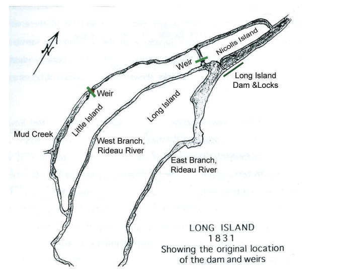
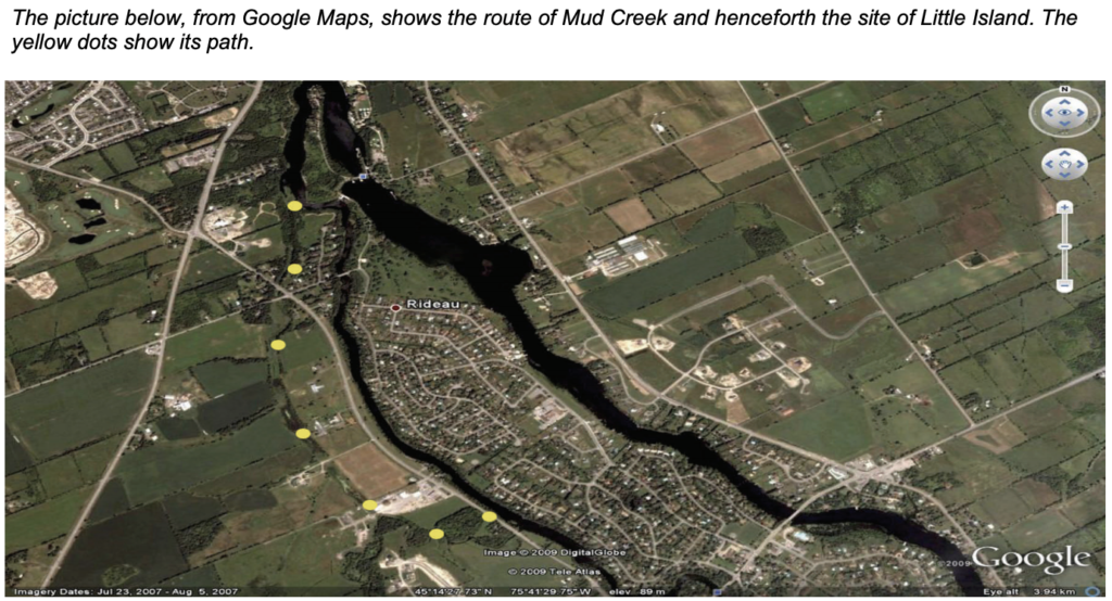
At present there is little water in Mud Creek. It empties into the Rideau in two places. In the process it crosses Rideau Valley Drive in two places where its remnants can be seen. The first place is at the little bridge about half a km. north of Bankfield Road, and the second at the junction of Rideau Valley and Barnsdale Road. Thus before the canal, the sites of the City Yard and Sand Shed, the Veterinary building, and the Guide Dogs were all on Little Island.
During canal construction a weir was installed between Nicolls Island and Little Island, and another across Mud Creek somewhere behind the Guide Dogs building. The purpose of these weirs was to deepen the water in the east and west branches of the Rideau River and prevent Mud Creek from draining water from the west branch around the weir at Long Island. This was the configuration when the canal went into service in 1832.
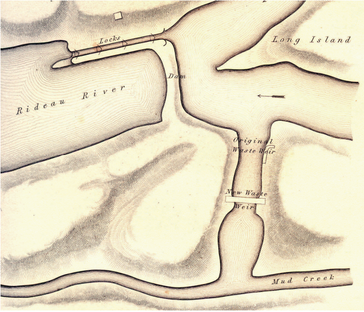
The above map is from an 1840 report from the Royal Engineers that describes the rebuilding of the weir across the waste channel between Nicolls Island and what used to be “Little” Island, now the mainland west of the west branch. (Report courtesy Mark Jodoin)
As can be seen from the map above, the east and west branches of the Rideau join at the northern tip of Long Island in front of the dam and locks. What is referred to as the waste channel (gets rid of excess water), joins with Mud Creek to form the branch of the Rideau that flows west of Nicolls Island and rejoins the main channel near the entrance to the Jock River. The map was made to show the location of a weir replacing one that had failed.
Although these weirs were substantial assemblies (see picture next page) with considerable stone ballast both in and around the log parts of the structure, mother nature often proved stronger. One or other of the weirs failed in 1836, 1841, and 1847.

The causes of failure would seem to have been the spring freshets bringing ice and eroding the soft clay bottoms around the base of the structures
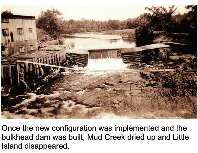
At one point in the struggles to find a solution to the problem of the failing weirs, they were both relocated. The one at the waste channel at Long Island was relocated to the gap between Nicolls Island and the tip of Long Island, the site of the present dam. The weir on Mud Creek was moved to approximately the site of today’s bulkhead dam at Watson’s Mill. The bulkhead was built in 1858.
The picture below, donated to the Rideau Branch, Ottawa Archives by George MacFarlane, shows the weir at the mill site prior to the bulkhead being built. The structure on the left side is probably the first sawmill.