Walking Tour of Historic Burritts Rapids and the Tip-to-Tip Trail
The Tip – to – Tip Trail
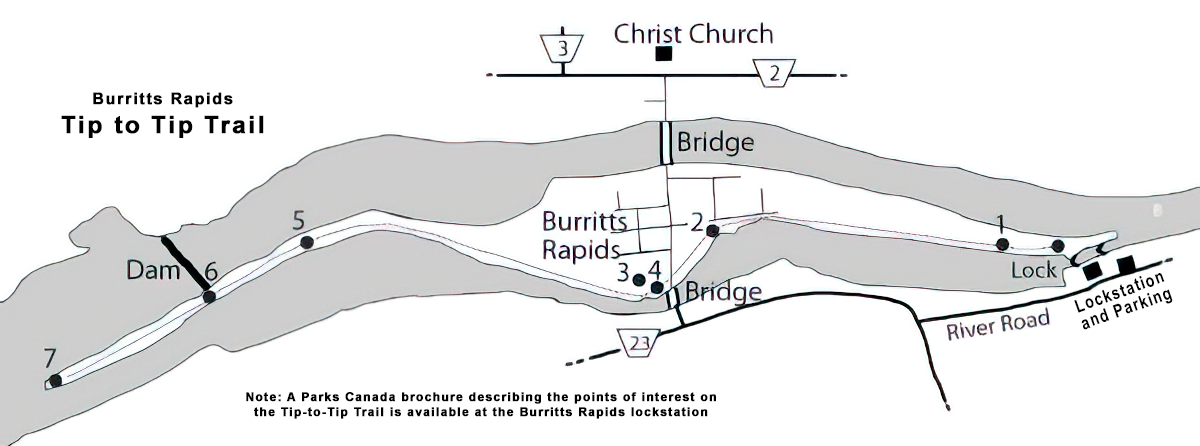
The island was created by the construction of the Rideau Canal. A dam was built upstream to bypass rapids and a channel excavated around the rough water. The 2 km trail leads past cool cedar forests, muskrat marshes, a beech nut grove and the pine covered upstream tip. You are walking on a soil ridge built by man 175 years ago. The embankment holds the canal channel water 15 feet above the river, just visible through the trees. The work involved in accomplishing such a task with shovels and wheelbarrows is difficult for a modern mind to grasp. The task was dangerous as well, with the twin hazards of malaria and gun powder claiming many lives.
A Parks Canada’s brochure describing points of interest along the Tip-to-Tip trail is available at the Burritts Rapids lockstation. The information in the brochure is also provided below.
The trail is an easy walk with a round trip length of four kilometres, taking about one hour to complete. Numbered trail markers along the path go with the following texts. They highlight features along the trail that were either influenced by or important in the construction of the Rideau Canal.
